




Marathon
13 years ago

You might not want to try what I tried not even an hour ago: crossing I-84 during rush hour. While there were large gaps in the traffic, the cars and trucks were spaced at annoyingly even intervals, making crossing difficult.
I had made it to the Exit 73 rest area, which is located on the eastbound side of I-84. This particular rest stop features a "caboose" of sorts run by a very nice lady who serves free coffee, tea, lemonade, and ice water (you can leave a cash donation that goes to a project in Africa; after three cups of lemonade and a bottle of cold water, I left two bucks). Turns out she's an EMT as well; she offered to soak my neck rag for me, and half-jokingly told me to be careful because she didn't want to have to come down the road and rescue me.
I asked the lady how to get over to the Memaloose campsite, which was just across the freeway at that point-- so tantalizingly close, yet so far away because there was no direct way across for either pedestrians or drivers. I told her I'd seen a sign at the rest area that said that eastbound travelers needed to go three miles farther down the road, get off at Exit 76, then backtrack all the way back to the Memaloose State Park exit, which isn't a numbered exit: it's in some sort of numerical limbo between Exits 73 and 74.
Walking six extra miles seemed like a stupid thing to do, what with the campground being right across the freeway, but the lady told me she'd check with some park workers she knew to see whether any other solution was possible. She called them up and then gave me the bad news: there was no other safe alternative.
I brooded at the eastbound rest area for an hour; while sitting at a cement park bench near a sign that said "Watch out for rattlesnakes," I met a gent who was walking his tiny dog. The guy was ex-Navy; we talked a bit about our respective travels, then I asked him what he thought would be the best way to handle my situation.
"Just cross the fuckin' freeway," he said. "Time it right, then go for broke." Then he and his dog walked off while I saddled up and began the trudge out of the rest area.
It was 5:30PM. Rush hour. With traffic moving along at a steady pace, I resigned myself to the idea of walking another six miles-- over two hours' more trudging. But when I had gone about a half-mile downhill and east, I saw a break in the traffic and decided, What the hell.
So against my better judgment, I took the ex-Navy guy's advice and went for broke. I couldn't do a dash, not with my heavy pack and my unsteady right knee, but I made it to the jersey barrier in the middle of the freeway, sat on it, and ballerina'ed my legs over it well before any eastbound traffic came near me. A westbound truck blew by, but I had seen that it was in the right lane; the left lane was clear, and once the truck roared past, the right lane was, too.
It may be legal to walk on Oregonian freeways, but I can't say I'd recommend doing what I just did. It's the closest I've come to playing in traffic, both foolish and dangerous, and to be honest, I'm not keen on repeating the experience, which felt like a real-life game of Frogger.
A while back, when I had first Googled the question of the legality of walking on Oregonian freeways, I stumbled upon a news article from last year about some woman who had attempted a similar crossing and had gotten splattered for her trouble. Visions of that woman were dancing in my head when I performed my own traverse; luckily for me, I lived to tell the tale, and had found a large enough gap in traffic that I had never been in real danger.
And now I need to set up my newly-cleaned tent. Memaloose State Park is a lot larger than I thought it was; it's also quite clean and grassy, a welcome change after the dustiness of Viento. A la prochaine.
_
I started my walk fairly late today; got up about 8:30AM, took my time packing up my tent and backpack, typed out that entry about my cat, and lumbered out the door at 10:50AM. Walked twenty minutes to a spot near the Hood River marina, and sat down down for a picnic.
When I was at Wal-Mart two days ago, I had bought some cheap food along with that roll of super-absorbent towels; I figured that paying $30 for four or five meals was better than shelling out $20 for a single meal. I bought typical single-guy food: bologna, deli-sliced turkey, bread, mayo, cheese, pasta salad, cereal, milk, juice, chips, and snacks (local-brand danishes and Ho-ho clones; a dollar per box).
I blew through the juice, chips and pasta salad, and made decent progress on the bologna sandwiches, but by this morning I still had a half-loaf of bread, plenty of bologna, most of the cheese, and some leftover snacks. It seemed a shame to waste the remainder, so here I am, chowing down on sandwiches and snacks, fervently hoping I can make it to the Memaloose campground without needing to take another ignoble pit stop on the side of the freeway.
Though I'm enjoying the junk foodery, my only beverage is water, and I'm jonesing for a large can of Coke. I know where I can find one, but I think I'll save my money for later.
The walk to Memaloose is barely ten miles, so I can afford to take my time. It's a nice day today, good for relaxing. At the rate I go, ten miles is about four hours' walk, and hitting Memaloose in midafternoon isn't tragic. The weather ought to be good for the next day or so; my next stop will be The Dalles.
And onward we push. As always, if you know of religious institutions along my projected route that might take me in, please email Kevin's Walk Central:
kevinswalkcentral [at] gmail [dot] com
_
The email I got from my brother David regarding our old cat Mozart:
Sad Mozart news: this past Saturday evening he decided to make the move from Alexandria, VA over to Kitty Heaven. He was an incredible 20 ½ years old and lived a very full life right up until his passing. We decided to bury him at home in his favorite sunbeam spot outside the house next to the chimney and driveway along with his favorite food bowl and a can of his favorite food... I’m sure he’s living it up wherever he’s at right now.
What's your notion of perfect weather? For me, it would be a lot like yesterday afternoon: temps in the high 60s and low 70s, sun shining, just a few clouds, and a constant breeze.
Yesterday, Rachael, my CS host in Underwood (by the way, Rhesus, "CS" means "Couchsurfing"), drove me back downhill from Underwood, then across the bridge to Hood River, where I am now. Because I had some miles to make up, and also because my room at the Riverview Lodge (15th and Oak) wasn't ready when I got there, I left my backpack in the motel office and took a long walk. It was around lunchtime, and I found a place on Oak that served something I hadn't had in a while: gyros. I stopped there, downed a beef gyro (as in Korea, the place served beef or chicken, no lamb) and some 7-Up, wandered toward the river, then walked back uphill to my motel. I stopped at an ice cream shop and had a scoop of "chocolate lover's chocolate" (essentially a slightly richer version of regular chocolate) in a waffle cone, then collected my pack from the Riverview's office and went to my room, Number 24.
Once inside, I unpacked my poor tent, which had spent more than 24 hours inside its sack, soaked and dirty. The whole rig needed a thorough washing and drying, so I stepped into the shower with everything and proceeded to cover the bottom of the tub with Viento State Park's dirt, sap, and leaf fragments. I hung most of the gear up on the shower rod, but realized that the only way to dry everything rapidly would be with some help. To that end, I strolled westward to the local Wal-Mart, picked up a roll of super-absorbent disposable wipes (and some cheap food), and went back to Riverview.
Today, the tent, footprint, various sacs, and even the tent stakes are nearing the end of the drying process. Tomorrow, I'm off to Memaloose State Park, and the day after that, I hit The Dalles, which my manager tells me is the largest city in the Columbia River Gorge. The character of my walk is about to change, from what I hear: the climate's going to become hotter and dryer, and towns will be fewer and farther between. While I'm in the Dalles, I'll likely buy some extra water containers. The added weight won't be welcome, but in the coming weeks, it will be necessary.
At least I had one absolutely perfect day.
_
A big shout-out to the huge cast of characters I had the great fortune to meet yesterday: Mystery Lady (who drove me across the river but didn't give me her name), Frank (my second driver, who had some interesting things to say about Buddhism and who knew one of the residents of the CS home I just left), Rachael and Todd (the dynamic mom and dad of this CS family), Anaïs and Che (the equally dynamic offspring), Shanti (the guest who's practically a member of the family), Lakota and Venus (the two huge dogs), and Vago (pronounced "vay-goh," not "vah-goh"; the horse).
I had a great time, and sincerely hope we keep in touch. Good luck with the future vineyard and the myriad other personal projects in which everyone seems to be engaged!
_
I've had to reject two anonymous comments. It's too bad, really; I wish people took the time to read the comments policy (click the link on the sidebar, folks; it's not hard). Neither comment was uncivil or otherwise objectionable. Alas.
_
Blogspot seems to be squeezing out a major brain fart right now, so don't be surprised if you're unable to read my blog (other Blogspot blogs are affected, too). I'm putting this message up in the hopes that you'll move the "Internet Explorer cannot open... Operation aborted" popup and read this text, which should be visible on your monitor.
[UPDATE: Is this a SiteMeter issue? (via Instapundit) I've removed SiteMeter for now and will replace it once the SM folks take care of their mess.]
Some interesting updates (read these once the brain fart clears up):
1. Today was a crazy day. The weather was one reason for the insanity: it started raining last night, so I had to pack the tent wet (and dirty) and haven't unrolled it yet to air (and clean) it out. The walk was characterized by simultaneous rain, wind, and sun, the latter member of that group being somewhat unexpected. I remember hearing, long ago, that on a day when it's both sunny and rainy, the Devil is kissing his wife. Heh. I would have thought that the Devil, being the Devil, would spend more time cheating on his wife.
2. I had been told that I would have to hitch a ride across the Hood River Bridge, and this was indeed the case. Many thanks to the very nice lady who drove me across.
3. After the bridge crossing, I began walking westward along Route 14 (this is in Washington, mind you; I've crossed the state line). It didn't take long before the shoulder disappeared almost completely, which was scary given the amount of traffic heading at me on that part of the road. Luckily, a dude drove past me and stopped at a pull-off; he waited patiently until I approached and asked me where I was headed. I gave him a vague idea where the Couchsurfing family's house was (it's in the town of Underwood); he very kindly drove me there, and even met the CS family. Turns out he knows one of the family's long-term house guests-- small world, eh?
4. Speaking of scary, I-84 can be scary, too. The freeway's shoulders are normally pretty wide; I generally feel safe walking on them. Occasionally, though, the shoulders will narrow to nearly nothing in the most inconvenient places, like bridges. This happened to me today as I was on the eastbound shoulder, just before Exit 63 (I was supposed to leave I-84 at Exit 64 to hit the Hood River Bridge): a small bridge appeared before me, basically an overpass, and the shoulder narrowed to nothing. I had little choice but to move rightward and uphill, which proved to be the right thing to do: I topped the rise and waded through some tall grass and onto private property-- a car repair place of some sort, with engine blocks and empty chassis all over the place. I never saw the owner and didn't feel like knocking on his door to apologize for the intrusion, so I simply hit the street in front of the shop and wandered onward into Hood River proper, still following I-84, which was visible beneath me. In fact, when I looked over at the freeway, I saw there was a pedestrian lane... but it was on the westbound side. Bad day for me to choose to walk along the eastbound side, eh?
5. Tons of grasshoppers over the past few days. A lot of the grass along I-84 was recently mown, so it all looks like an orgy of hay. In the midst of this chaos are light brown grasshoppers that leap crazily in all directions like wigged-out children fleeing a rampaging dragon. The most hilarious grasshoppers are the ones that leap so strongly that they're caught by the Gorge's strong winds and blown toward I-84's traffic. The image brings back the old riddle: "What's the last thing to go through a bug's mind when it hits your windshield?" You know the answer.
6. I made the news! Thank you, Sue Ryan, for your kind article in the Hood River News. Everyone: go take a look.
7. At my current CS residence, I had the chance to weigh myself: 256.2 pounds. Down from 297 at the beginning of this walk: a loss of 40.8 pounds. Still fat, though. As Yoda might say: Much to lose, you have. A nice, even 200 will be nice. Any bets on whether I hit that figure by the time I exit the Plains states?
8. A few things I can say about the place I'm staying at: first, this is a family that knows how to cook. Nothing but great smells emanated from that kitchen this evening; dinner was largely Indian-style, with some good ol' salad thrown in at the end, and a magnificent pie that awaits my gullet when my hosts return from an evening outing (I had promised to wait until Todd and Rachael, the parents, had come back from a First Friday celebration). Second, this is obviously a very loving family: the daughter and son, Che and Anaïs, are cheerful and energetic teens; the teenaged house guest, Shanti, is also a great guy and seems to be part of the family. Third, what's not to like about two huge, cool dogs? Fourth, everyone here is brimming with creative and intellectual energy, and we've already had some pretty intense discussions about religion, atheism, education, mycology (a subject about which I know nothing), music, various cultures, and what the future holds on both a personal and corporate level. Rachael asked me what I had learned so far on my trip; I told her I'd learned that I probably shouldn't be too cynical about people, given the sheer number of kindnesses, large and small, from which I've benefitted. It's true.
And that's your update for now. Here's hoping the Blogspot nonsense clears up soon, so you can read all this.
_
I hope my hosts for tonight won't mind that I'll be setting up my tent on their property to air it out.
I'm walking about 15 miles to Underwood, Washington. Part of the walk includes a crossing of the Hood River Bridge, which according to my host can be done only by hitchhiking, so today will be my first experience with that. I've never put my thumb up for a car before.
Hey...I didn't eat anything yesterday! I think I was more thirsty-- and tired-- than hungry; I crawled into my tent before 8PM and went to sleep, woke up cold around 2:30AM, deployed my sleeping bag as a blanket, and went back to sleep.
More later, but BlackBerrying in the rain isn't a good idea, so updates won't be frequent.
_
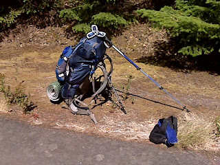
As you can see in the previous pic, I'm taking a brief rest before moving on. I'm just off I-84, along which I've been walking most of this time, having taken Exit 51 (Wyeth campground exit) to get away from traffic and enjoy a spot of shade. I've been walking for about two hours, and have been moving along at a surprising rate of about 3mph. I attribute this more to the generally smooth terrain than to my improved physical condition; I still have a long, long way to go before I can declare myself "in shape."
I'd like to take this opportunity to thank Barb and Bob, pictured earlier, for being such gracious and friendly hosts during my four-night stay at their KOA campground. All the staff were friendly and quick to help out; I had a good time. (Now let's see about introducing $15/night hiker/biker rates, like many state parks!)
Also, a big GET WELL SOON to Malcolm, who's been laid up in the hospital. Meanwhile, his group of Job's comforters have been hammering at his naturalistic take on morality (or at least the origins of morality); scroll down and have yourself a read. One post has over a hundred comments!
Yesterday, my brother David told me his longtime boss very suddenly died of a heart attack. Everyone at his office is in shock; the lady in question was to all appearances in perfect health, and was preparing to retire. You never know when death's gonna come a-knockin', so make sure you enjoy each moment as fully as you can.
And with that, break's over. Time to saddle up and head on to Mile 56, Viento State Park, where I'm stopping for the day. Tomorrow, I'll be staying at a Couchsurfing home across the river in Washington (this apparently requires a hitchhike across the bridge, which means I'll have some distance to make up by walking). More on my schedule once I settle in later today.
_
While at the library today, I overheard a conversation between a dude at another computer and a teenaged girl who was amazed to discover that the guy was on a transcontinental walk. In his case, he's walking from Mexico to Canada ("sure beats having a summer job") along the Pacific Crest trail. No fireworks, no fanfare-- just walking. He ditched his tent somewhere along the way: "too heavy." Now he's down to a sleeping bag and little else. Gotta respect that. Hiking the trail must be tough.
As I was leaving, I shook the guy's hand and told him I was on my own walk. His name's Jordan, a name that evokes crossings and personal transitions (e.g., baptism in the Jordan). Happy trails, man. Walk well; stay safe.
_
Toward the end of my interiew with Sue Ryan yesterday, I mentioned that I had begun to dwell more and more on the question of lack of interest among believers when it comes to finding out about other religions. I used the image of the valley community to make the point that many folks are satisfied with where they are in their valley, and aren't all that curious about what might be going on in the next valley over.
This may be one reason why connections between and among religious communities tend to be incestuous: Zennists know other Buddhists, but might not have ties with the local Sikhs; the Sikhs are well networked with other Sikhs, but might not have connections with local Catholic churches, and so on.
The issue of incuriousness (if that's even a word) is worth exploring, and I'm beginning to wonder whether I should replace one of my Ten Questions with one about this phenomenon. Perhaps the answer to the question lies in simple human psychology: people tend to settle, and tend to think only in terms of their own needs. But while that may be true, there has to be more to the issue, especially given the open-heartedness that religions supposedly preach.
More on this later; right now, I'm about to hit the 'brary again.
(By the way, the Hood River News article is slated to appear on Saturday.)
_
The rain has ended and BlackBerry service is fully back: I can even surf to Blogger, which is how I'm typing this entry. I'll be extending my stay by one more day to give my tent time to dry (it rained most of the night), which means I might be able to make it over to City Hall to use a library computer and get some route work done today. We'll see.
_
I left my BlackBerry in the campground's main building to charge for two hours, from 6 to 8PM. During that time, Mother Nature finally realized she hadn't truly rained on me in a while, so after teasing us all day with light and random shower activity, she suddenly opened the floodgates and let loose with a real summer rain.
This changes my immediate plans, of course, because unlike the typical weekend traveler, I can't say to myself, "I can pack the tent wet; I'll just air it out when I get home." My tent, billed as a "three-season" shelter (i.e., all but winter), goes where I go, and home isn't a place I'll be seeing for at least another year. Packing the tent wet means risking mold and mildew.
So I can't afford simply to pack and go; the tent will need time to dry up and air out, and since tomorrow's forecast is partly cloudy, I'm hoping that'll be sufficient for my purposes.
Upshot: I'm staying an extra day.
PS: Internet capability restored, but wouldn't you know it: I still can't access Blogger (the browser times out), so I'm once again resorting to moblogging via email.
_
Sent via BlackBerry by AT&T
Many thanks to Sue Ryan of The Hood River News for stopping by my regal KOA digs and chatting with me today. Thanks, too, for the wealth of information about Native American sights to see along the river and WA/OR border. I know next to nothing about Native American religion, and it would be a shame if my walk failed to include any mention of this aspect of the American religious landscape.
(NB to readers: The Hood River News is available online; I'll check with Sue as to when the article comes out, but feel free to give her paper some traffic before then!)
_
Sent via BlackBerry by AT&T
I had a very nice and fattening lunch of bacon double cheeseburger (no onions!), tater tots, and a large chocolate milkshake, all from that hamburger/ice cream joint. The burger was easily one of the best I've ever eaten; the tater tots were deep-fried and salted to perfection; the only thing not totally spot-on was the milkshake, which was great at first, but which became cloyingly sweet by the end. Lesson learned: order a smaller milkshake next time, and carry around some water as a chaser.
But it looks as though I won't be hitting the library again. I finished lunch around noon and reached the 'brary about 12:10 (I had set up camp under one of the eaves of the marine park's visitor center, which kept me shielded from the periodic showers we've been having today); when I got to the library's door, I looked inside and saw the place was packed with a ring of elementary schoolers and adult chaperones-- some sort of story hour, at a guess. I considered waiting, but realized that my interview was scheduled for 2PM, which meant I'd have almost no computer time at all. So I decided to head on back to the KOA campground, which is where I'm meeting my interviewer, and where I am now. Since the 'brary closes at 3, I won't be going back there unless I stay in Cascade Locks an extra day.
Still no Internet on my BlackBerry. I can use the phone, send text messages, and send emails without attachments, but everything else is dead. I still don't know why this suddenly occurred (I had Internet when I first arrived at KOA), and I can say I'm literally an unhappy camper right now.
Tomorrow I head out to Viento State Park, which is about 12 to 15 miles from where I am (I have to go from Exit 44 to Exit 56 of I-84; tack on some extra mileage for those stretches of road before and after the exits). I'll be doing this without MapQuest, so I can't calculate exact mileage.
Viento is a first-come, first-serve campground; because it's a state park, I'm hoping it'll have a hiker/biker section like the parks in Washington. The rates seem about the same as WA state park rates ($14-15/night); where I am now, at KOA, there's no hiker/biker rate, so I'm paying about $30/night. See where my money goes? And you thought I was pissing my finances away on booze and three meals a day, didn't you?
OK...all for the moment. Once my Internet capability is back, I'll put up some more pics I've taken. It's a great little town.
_
Sent via BlackBerry by AT&T
I'm writing this post from Cascade Locks's City Hall, which doubles (triples?) as a public library and gym. You sign up for a half-hour of computer time and if no one else comes, you can sign up for another half-hour, etc. The 'brary's open from 10AM to 3PM.
My campground turned into a dead zone for data exchange, so I was completely unable to surf from the BlackBerry yesterday afternoon and evening. Now that I've relocated a mile down the road to the library... just a sec... checking... I appear to be having the same problem. You'll recall that I had this problem on my previous BlackBerry as well. I had thought the problem was with signal strength or some other issue external to my handheld, but now I'm beginning to wonder if there isn't something about my device that's overly finicky. The message I keep getting, when I try to surf to a given site, is "A problem occurred while trying to render the page." This usually pops up after the progress bar has been loading for a few seconds, followed by the Twirling Hourglass of Death. The message appears with a friendly "OK" prompt; I click "OK" and that's that. This is why it's dangerous to cathect your BlackBerry.
There's a burger joint up the street that everyone flocks to, and even though I've been in this town a few days, I haven't visited it yet (nor have I visited the massive Char Burger at the "front" end of town). When my time runs out on this computer around 11AM, I plan to lumber over to the burger joint before there's a crowd and find out what the fuss is all about. The place also sells ice cream, so this might be a burger-and-ice-cream sort of lunch.
While doing laundry early this morning (I went to sleep very early, then woke at 5:30AM with a cramp in my neck), I found myself staring at a map of the US. I traced my progress downward from White Rock, BC to Portland, OR, then eastward to Cascade Locks, and saw how little progress I've made in two months (Sunday was the 2-month anniversary). I've crossed one state and am crossing it again, in a sense, by following its southern border eastward. Or maybe you could say I'm crossing two states at once since Washington and Oregon share this particular border. Anyway, it's humbling to realize how far I have to go.
Burger break now. When I get back, I'll get on Google Maps and really figure out how long that recent walk was.
_
I don't know what the deal is, but I'm once again in some sort of data dead zone, unable to surf anywhere with the BlackBerry's browser. I'm using email to publish this blind, which ought to be OK: I've managed to send other emails even while the browser's been funky.
An interview I'm hoping to have with Susan Ryan, a staff writer at the Hood River News, has been moved to tomorrow (Tues.), so today's just a day for chillin' out. I'll likely do laundry tomorrow morning, well before the interview.
My Solio charger works, but requires a long time-- about an hour-- to soak up enough sun to provide even a few minutes' charge. I probably need to let it sit in direct sunlight for nearly a whole day if I want it to build up enough power to charge the BlackBerry even halfway.
Planning the day-by-day specifics of the route requires the BlackBerry, but it's charging off a wall socket of the KOA campground's main building and is, as noted, currently useless for surfing. So I'm stuck by the building for the time being. With so much out of my hands right now, I might turn in early again tonight.
_
Sent via BlackBerry by AT&T
I had a very nice half-hour chat with Bernice Harbaugh this morning. Given the snail's pace at which I work, I suppose it'll be at least a month before you see the transcript. This conversation was probably the first in which I actually went down my list of religious questions.* We didn't do all ten, but we got through a lot of them, and luckily for me, my interviewee had a lot to say.
Thank you, Bernice, for taking the time to sit down with me!
It's a red-letter day when a vampire like me gets to bed before 10PM, but believe it or not, I'm outta here at 9:15. As was true of my previous nights in the woods (Lewis and Clark State Park and Millersylvania State Park), I think I've been very lucky to have been able to set my tent up in ideal conditions-- on a campground, in pleasant weather, with almost no wind.
I'm here at this KOA campground for three nights, leaving right before the rain (we hope). Tomorrow morning, I'm interviewing Bernice Harbaugh, the very nice lady who runs the Cascade Motel. Later in the day I'll be mailing back even more bulky "unnecessaries," and continuing to work on my route planning while also fiddling with my Solio solar charger.
Stay tuned.
_
If I'm not careful, this could be me.
Actually, I'm not the type to text while walking, nor do I like talking on the phone while walking. In both cases, I prefer to stop and devote my full attention to the telephone/online activity, not so much because I'm practicing mindfulness as because I'm an awful multitasker.
Because stopping during my walk is a chore-- it's devilishly hard to start back up again-- I prefer to make and receive calls only when I've settled somewhere. When I'm on the road, I'm sweaty, which means drenching the BlackBerry in sweat when someone calls.
This is one reason why I prefer emails and text messages. I've tried walking and talking before, but often find it hard to hear my interlocutor. The effort of talking while walking doesn't seem worth it when most conversations become laced with "Can you hear me now?"s and "Say again?"s, despite having the volume on maximum setting.
_
I've had several invitations to stay with various friends and acquaintances. The following picture is pretty sketchy and is, as always, open to revision, but perhaps if I try to lock these points down, it'll be easier for readers to help us connect the dots (as always, I ask you to click on the "How Can I Help?" link on the sidebar).
What I have so far:
1. An invitation to stay with a college buddy and his family in South Dakota (Paul).
2. Two invitations from people in Illinois (HK and S. Honeywell).
3. One invitation to stay at a location in Indiana (Terry Douglas's relatives, right, Terry?).
4. One invitation to finish the journey in New York City (Malcolm).
I've received other very kind invitations, but they were, for the most part, from regions too far south of the route I was leaning toward; I'd prefer to hang north because I know the heat will kill me. I may also have received other invitations along the general path described above (I'll need to get back to you with cities); if I've neglected to mention you, please remind me of your invitation.
So: from the Pacific Northwest, I'm thinking of connecting the dots across South Dakota, Illinois, Indiana, and New York. That leaves a lot of gaps to be filled in, with a good bit of zigzagging possible based on weather, terrain, and human factors. Contact Kevin's Walk Central if you have suggestions.
In the meantime, here's Alan Cook's itinerary for me; it's designed to take me along the WA/OR border and into Lewiston, Idaho.
1. Cascade Locks to Hood River. (17 mi)
2. Hood River to The Dalles. (26 mi); I might stay here a couple days to visit with Alix-Gay's father and see the Dalles Dam.
3. The Dalles to Biggs, or to a campground at Maryhill State Park, WA (18-19 mi)
4. Biggs to a point halfway to Arlington: Chamberlin-Goodnoe Road (16.5 mi)
5. CG Road to Roosevelt, WA (19.5 mi)
6. Roosevelt to Crow Butte Park (20.5 mi)
7. Crow Butte Park to Paterson (12 mi)
8. Paterson, WA to Umatilla, OR (14.5 mi)
9. Umatilla to Hat Rock Campground (8 mi)
10. Hat Rock to Pierce's Green Valley Campground (approx. 19 mi)
11. Green Valley to Touchet (12 mi) or Lowden (17 mi)
12. Touchet or Lowden to Walla Walla (17.5 or 12.5 mi)
13. Walla Walla to Waitsburg (20 mi)
14. Waitsburg to Dayton (9.5 mi)
15. Dayton to Last Resort KOA Campground (approx. 17 mi)
16. LR KOA Campground to Pomeroy, WA (16 mi)
17. Pomeroy to Chief Timothy Park (22 mi)
18. Chief Timothy Park to Lewiston, ID (approx 10 mi)
If you've got remarks or suggestions about the route, please write Kevin's Walk Central:
kevinswalkcentral [at] gmail [dot] com
I hope this starts to clear things up. By the way, I might stop a while in Walla Walla and see about earning some cash. Does anyone need a French tutor/instructor, or someone to teach basic Korean? How about an informal course on major world religions? I'm also pretty good at moving boxes around (though not with a forklift), and would LOVE to earn money splitting wood (axe, not wedge; I'm no good with a sledge-and-wedge). I've got other skills, too, though my days as a gigolo are long gone.
Stay in touch.
_
The face rash appears finally to be receding. I'm left with two large pits on my face, one on the upper right side of my nose, the other under the inner corner of my right eye-- more souvenirs from this trip.
Of course, my problems pale in comparison to those of the people, both inside and outside the US, who've been hit by the recent hurricane; keep those folks in your thoughts and help them if you can.
More in a bit; I promised to give you an idea of my overall route, and that's coming up.
_
I did a MapQuest calculation connecting my Troutdale motel to Corbett High School, which I'd passed during my long walk, then did another calculation connecting the high school to the Cascade Motel. The result-- which is actually a conservative estimate-- showed that I had done about a whopping 31 miles from Troutdale to Cascade Locks. I'm thinking the actual distance was 32-34 miles, which is absolutely insane, not to mention a new record.
Never again. I hope.
_
Today, I'm checking out of the Cascade Motel (which I highly recommend to travelers), but cannot move down the street to the KOA campsite, which is booked solid through today. I was told, however, that I could "have [my] pick" of tent sites tomorrow (Sunday).
So the plan is either to walk up the street to stay one extra night in a different motel, or to walk over to the RV campsite (where I took the Canada geese pics yesterday) and see if I can stay there one night. I wouldn't mind simply extending my stay here at the Cascade Motel an extra night, but if I'm not mistaken, this unit is spoken for, so I have to vacate the premises.
I'm staying in Cascade Locks an extra couple of days because there's a good chance I'll be interviewed by the local press, and I might be interviewing at least two people here. Along with that, I've got some trip planning to do, as I've found a map that provides info on some stops that might shorten the length of some of my upcoming hikes.
More later, once I'm settled in again.
_
If I remember my M. Scott Peck correctly, cathexis is a term used in psychology to refer to the extension of one's ego-boundaries toward and around something outside oneself. Example: when a guy cathects his favorite football team, their triumphs and disappointments become his triumphs and disappointments, even though the team has no idea the guy exists. Cathexis is therefore often one-sided, as it can happen not only in dude-team situations, but also in dude-inanimate object situations.
With all that in mind, I confess that I've probably cathected my BlackBerry, and have cathected various other pieces of Walk-related equipment. This state of affairs was brought home to me today when, while my laundry was perking, I decided to take a stroll across the Bridge of the Gods.
The bridge is located a few dozen yards uphill from the laundromat; vehicles entering and exiting on the Oregon side must pay a toll. Pedestrians, as the grandmotherly lady at the toll booth informed me, may cross the bridge for free.
Not having read anything more than Alan Cook's comment (appended to a previous post) about the history of the bridge, I simply started across, my eyes sweeping the bridge for some sign of a pedestrian lane. Seeing none, I shrugged and moved onto the span.
Are you the kind of person who never watches his/her feet when walking? Long years of bad luck have made me the sort of person who watches where he's going; the moment I stop doing so, I'm sure to step on a stone or partway into a pothole (this may, in fact, have contributed to my fall back in Washington). Were I to look up while descending a staircase, I'd be Gerald Fording every time.
So I was looking down when I started across, and after a few yards I stopped cold, because what I saw froze my heart in my chest: the grating under my feet allowed a full view of the bridge's underlying structure and the Columbia River. Yikes.
It was years ago that I discovered I had a thing about heights. One summer when I was in high school, I worked construction. It was very educational, and the gentleman who hired me, a man from our church, paid me very well by 1980s standards: 20 dollars an hour.
But I spent only two weeks on the job because I learned I was a zero at construction. Three incidents motivated me to quit: first, I forgot to lock the wheels on a rolling scaffold, and the thing slipped out from under me while I was working on a joist. The scaffold rolled toward the rectangular hole in the floor that was to become the head of a set of stairs (I was at attic level); it fell sideways into the hole and stuck there, while I hung stupidly from the joist, watching the disaster unfold.
Second, while outside the house, I was asked to carry a bucket of nails up to some guys on the second floor. To do this, I had to use a long ladder that was leaning against the side of the house. As I climbed, I could feel the ladder shaking beneath me, and I was gripped by the conviction that I and the ladder were going to pitch sideways. I'll never forget how much that ladder shook.
Lastly-- and this was the straw that broke the camel's back-- I was on the roof laying out roofing paper, laying chalk lines, and hammering nails into the chalk lines to fasten the paper to the roof.
Laying out the roofing paper was easy and didn't even require standing (or maybe it does require standing, but no one ever told me otherwise). You simply sit on one side of the roof with your huge, heavy roll of black roofing paper, then bowl it across the roof so that it covers a strip of the roof as it unrolls. After you've done one strip, you shift to an uncovered portion and repeat the process with another roll of paper.
Creating the chalk lines did require standing, which is when it finally began to dawn on me that I might have a serious thing about heights. The device that makes the chalk line looks like one of those heavy metal tape measures. Once you determine where the underlying joists are, you hook the chalk line to the edge of the roof, move to the roof's peak while making sure the chalk line is exactly over the joist, then you snap the line, which is covered in chalk. If you've done your job right, you've just given yourself a reliable guide that'll help you drive your nails in a straight line, securing the roofing paper to the joist below (the joist generally isn't visible because the roof is usually covered, at that point in the construction process, by large rectangles of plywood).
I managed to snap a chalk line correctly, but it was when I began to hammer the nails into the roof that I knew this was my last day on the job. I had worn all the wrong clothing for construction (wrong clothing seems to be a recurrent theme in my life): I had on my New Balance running shoes and a pair of sweatpants, much like the heavy cotton things I just sent home. Bad move: neither my shoes nor my pants allowed me a firm purchase on the smooth roofing paper, so each blow of my hammer sent me inch by inch toward the roof's edge. I had started hammering from the very top of the chalk line, but as I drove successive nails closer to the roof's edge, I felt I was going to fall off. I can't remember whether I finished all the chalk lines or not; I suspect I quit early that day. I do remember apologizing to Mr. Lowdermilk for being a poor worker; he took the whole thing with good humor and paid me fairly for my work. Maybe "work" should be in scare quotes. Frequent commenter Max Watson is right: I'm a wuss.
So that's how I discovered that high places and I generally don't get along. That fear was brought back to me today as I realized that only a thin gridwork of rusty metal lay between me and a long plunge to the river below. The blowing wind, a near-constant feature of the Gorge when you're near the river's edge, wasn't helping matters.
My fear was irrational, of course: cars were rolling placidly back and forth across the bridge, a testament to its trustworthiness.* I also found that, as long as I didn't look down, the bridge appeared solid, and I was much calmer as a result.
While walking from the Oregon side to the Washington side, I pondered taking a downward-pointing photo with my BlackBerry, a thought that sent a new thrill of fear through me. This is where cathexis played its role today, for I couldn't help feeling that, if the BlackBerry slipped from my fingers and fell into the river (the gaps in the bridge's surface could easily allow the BlackBerry through), this would be like me slipping through the bridge's surface and into the river.
It wasn't until I'd forced myself across to the Washington side that I decided to take the BlackBerry out and get it ready to take pictures during the return trip to Oregon and my laundry. I snapped a pic of the bridge's entrance from the Washington side, then started back across, keeping my eyes up until I was far enough to be over the river. Cars in the oncoming lane passed me with polite, deliberate slowness; I began to wonder how many pedestrians crossed this bridge each day. Once I reached a decent spot, I steeled myself, looked down, aimed the BlackBerry at the grid, and snapped the photo you saw in a previous post.
While I'm perversely proud to have crossed the Bridge of the Gods twice on foot, I admit it's not an experience I'd care to repeat. However irrational it was, the fear was real.
One final note: never having been to a therapist, I haven't been officially diagnosed with acrophobia (come to think of it, I'd also like to be tested for dyslexia). I do know that I'm OK with heights when I'm on soaring balconies, bridges with high railings, and mountain paths and overlooks with safety features like handholds and such. I've been up Seoul's Bukhan Mountain a few times, and that's a place that might scare a severe acrophobe. I mention all this in anticipation of questions like, "If you're so afraid of heights, why are you doing this walk? Didn't you realize you'd be dealing with heights?" I have a problem with heights, yes, but in general, if I feel that security is within arm's reach, I'm OK. A staircase can be a thousand feet tall, but if it's firm and has high railings, I can climb it. By contrast, I can't see myself tackling an obstacle like the US Air Force Academy's Tiltin' Hilton. No, sir.
I still don't know how far I walked all Wednesday and early Thursday, but wouldn't be surprised to discover it was over twenty miles.
Back at Chanticleer Point, I met a Korean family that was doing a driving tour. We spoke almost entirely in Korean; I asked them what they were doing, and they asked me what about my walk and how I was dealing with blisters and such (my hiking shoes give me no more trouble, by the way; they appear finally to have been broken in). I haven't had blisters in a while, which is great. Even at the end of yesterday's long hike, nada.
Man, yesterday feels as though it happened a year ago. The first half of that hike was a lot of fun-- passing through downtown Troutdale and Corbett, stopping at the Chanticleer and Crown Point overlooks, enjoying the great weather and gorgeous scenery-- fun, indeed. But the second half of the journey, which involved descending to the water's level, feeling trapped on the Historic Highway, then finally reaching the freeway and walking along it, was a world of hurt.
Surprisingly, my knee held up pretty well through all of it. I was shuffling along at a little more than 2mph; during the night, I passed a number of sightseeing stopping points on the Historic Highway, the most memorable of which was Horsetail Falls, a waterfall that, unlike Multnomah, was immediately visible from the road, and did indeed look like a flowing horse's tail, ghostly gray at night.*
The Historic Highway played with my emotions until the very end, when it finally turned and plunged into I-84. Before the end of the highway, I passed the Ainsworth campground and seriously considered stopping there for the night, but some stubborn impulse kept me pushing onward toward the freeway.
In retrospect, I think stopping at Ainsworth would have been the better choice: reaching the freeway wasn't the solution to my problems. While it's true the freeway isn't as hilly as the Historic Highway, exits are few and far between. I was reassured by the freeway's broad shoulders, but walking along the freeway, even after 2AM, is a gritty, noisy business. All the trucks are out in force, headlights glaring, engines roaring, kicking up gusty, sandy wakes as they pass by.
The temptation to stop grew in force as time dragged on that night. I was walking eastward on the westbound side of the freeway, head bowed in anticipation of truck gusts, and frequently looking to my left, evaluating patches of grass and dirt for their camp-worthiness. I wondered whether I could get away with lying just behind a jersey barrier, out of sight of all drivers. In almost every instance, I decided against it.
Around 3:30AM, though, it had become too much and I knew I needed to stop. A leftward glance showed me I was near some sort of narrow road or bike path, separated from the freeway by a screen of vegetation that varied in thickness. I wearily stepped off the road and walked until I was behind a thick patch, then removed my pack and sat heavily down, doing Not Much of Anything until I felt I could move again. My fanny pack, which contains my toiletries and hangs off my neck when I'm hiking, frequently doubles as my pillow; I unrolled my foam pad (after realizing how cold the asphalt was; it was a very cool night), took out my windbreaker and my dad's poncho, then kicked back with my foldable, laminated map of Oregon to see what I had passed and where I was headed.
Earlier, I had looked across the interstate and, with the aid of my flashlight, seen the big green sign announcing that Cascade Locks was eight miles away.** When I looked at the map, I saw that the city's name was written in medium-sized print, i.e., this wasn't a one-horse town. A Google search of hotels in Cascade Locks revealed several, including a Best Western whose rooms were in the $110-$120 range-- too much if I planned to stay two nights.
Anyway, I was glad to see that Cascade Locks had what I was looking for. I decided to take a nap on the bike path, and I slept from about 4AM to 5:15AM. The sky was brightening and the stars were gone when I rolled up my poncho and foam pad, and creakily re-shouldered my backpack. The morning was still cool, so I kept my windbreaker on, though I eventually threw the hood back once my noggin began emitting too much heat.
And now comes the part of the narrative where some of you more delicate folks might want to turn away, because I'm about to discuss what it's like to poop en route without recourse to the accoutrements of civilized society.
I pooped twice during my walk-- once while on the Historic Highway, and once more on I-84, not long after waking up from my nap.
My first session occurred while I was at that parking lot described in a previous post, the one where all was dark and quiet except for the rude SUVer who drove into the lot, shined his headlights at me, and drove away.
The cover of darkness is bizarrely reassuring when you need to poop in the open, but it also prevents you from doing a proper finger-check to make sure you haven't sullied your digits during the wiping process. At the moment when I needed to go, I had a flashlight with me, and was able to find a spot well away from the road at which to do the evil deed.
I've never been a good squatter, so when I'm in the wild I require something to grip for balance, like a thin tree trunk or a low tree branch (in the squat toilet stalls in Korea, I normally brace my hands against the cubicle walls). Nature provided: I found myself near a tree with a low, dead, barkless branch-- the perfect handhold. After that, it was a matter of "dropping trou," as they say, and letting fly.
My greatest fear, whenever I squat-poop, is that I'll accidentally hit my pants. This is why, in Korean toilet stalls of the squat variety, I simply take my pants off. But out in the open here in America, pooping on public land with the possibility of being seen by any random driver, I thought it best to keep the clothing on in case I suddenly needed to button up. So in the end, I had to squat very carefully, using my handhold to help me lean back and provide Harry Enos with a clear shot of the ground. It worked. I wiped using the porta-pack of tissues I'd brought along (one of several such packs). A flashlight-aided finger check confirmed digital cleanliness, though I did see a glistening patch on my palm that turned out to be pine resin. I'm glad that's all it was.
But almost immediately after wiping, I was struck by the urge to poop again. I attribute this to the evening coolness; as much as I like cool weather, it often makes me want to dump. So I redid the whole stinky procedure, from squat-prep to finger-check, and managed once again to avoid hitting my pants.
That's when I realized I'd forgotten to dig a cathole, which is what you do in the wild when pooping. You dig the cathole, keep the dirt nearby, void into the hole, and replace the dirt on top of it.
I had a trowel buried somewhere in my backpack for just that purpose, but in my fatigue I didn't want to bother taking it out, so I used my shoe's heel to scuff out a cathole next to the landing site, then used some nearby sticks to maneuver my leavings (and tissue) into the hole and cover the whole thing up. I placed a few rocks atop the burial site to mark my, er, passing, then made my getaway not long after.
The second poop session was far worse, as it occurred around 6AM, i.e., in broad daylight-- and on the freeway, no less. I was somewhere between exits 40 and 41 when the intestinal urge struck again, strongly, making me wonder whether the gods were playing a sick joke on me.
I've been in similar straits before; my normal strategy is to stave off the horrible feeling of increasing pressure by counting breaths or by taking a random phrase and making it into a mantra that takes my mind off the impending cataclysm. But in every previous case, I had some idea how far off the nearest toilet was. On Thursday morning, I had no clue when, or even if, I would happen upon a place where I could crap in peace.
By 6AM, the freeway was a crowded place, with almost no carless intervals, and therefore no time to hop the barrier and disappear into the bushes. And in my case, loaded down with a backpack, fanny pack, and trekking pole, shedding my equipment before shedding my load would take time. In other words, I couldn't just make myself vanish, ninja-like, from the road.
As the brown urge became overwhelming, though, I became less worried about what some random drivers might think of a nameless guy moving into the bushes. All I wanted was a place that was out of sight of traffic, which meant walking until I found a patch of ground that sloped downward and offered adequate cover.
I found what I was looking for not long after crossing a bridge. At the end of the bridge, the ground sloped away. Tall grass, Queen Anne's lace, and some unidentifiable thorny plants graced the margin closest to the freeway, and a thick patch of bushes screened me from oncoming westbound traffic. I would have been visible to eastbound traffic, but at that point on the freeway, the eastbound lanes were separated from the westbound ones by a wide median.
Nearly frantic at this point, I brunted my way through the grass and thorns, walked down the short slope until I was hidden from traffic by the bushes, dropped trou, gripped a pile of fallen branches and twigs for balance, and let fly with a bellow of relief that was immediately covered up by the noise of the traffic. As before, I managed the miracle of not hitting my own clothing, Allah be praised.
You can't know how worried I was that a police cruiser was going to stop where I was right then, but I encountered no police at any point during my walk on the freeway. About a mile or so farther down the road, I stopped at a spot that would have made for a far better pooping site; while there, I called various hotels and motels, which is how I ended up at this, the Cascade Motel.
I'm sorry to have put you through the agony and ecstasy of the poop story, but this is a special situation. Unlike when you're going from house to house, toilets aren't readily available on the freeway; there are no residences, gas stations, hotels, or porta-johns to succor you. And unlike when you're camping, you aren't guaranteed the privacy that comes with being in the wild (or at least having access to a campground toilet): cars are everywhere, and cover is hard to find, especially if you're loaded down with a backpack and other equipment. That's something for you prospective transcontinental walkers to keep in mind.
I reached the Cascade Motel, which lies outside the town center, at 8:57AM, having taken Exit 44 off the interstate to reach Cascade Locks. The town is small and tourism-oriented; the main drag greets you with a Best Western and a Char Burger restaurant, along with some other local hotels, a few shops and ice cream places, and the inevitable Shell and Chevron gas stations that seem to dominate the Pacific Northwest.
The lady who runs Cascade Motel is very nice; she allowed me to check in early. I got my key for Room Number 1 (shown previously), shed my equipment and clothing, took a shower, and was dead in bed by 10:30AM. I woke around 3:30PM, then must have gone back to sleep, because when I woke again it was dark outside.
All in all, that Wednesday-Thursday walk was a real adventure: draining, frightening, and frustrating, but also a pleasure. I had the chance to meet new people, drink RC Cola, and enjoy some incredible vistas. What more could you want?
And now that it's 5:45AM, guess what: I'm gonna sleep some more!
A note before I go: I'm very achy right now, so it's possible I'll hang around Cascade Locks another day or two. I didn't know this, but the motel lady told me there's a KOA campground not even a mile from where I am. If I do decide to stay longer, I'll be shifting to that site.
It's about 11:30PM, and I've been walking pretty much all this time. I stopped at Bridal Veil Park to take a much-needed dump (hello again, turkey club sandwich!), but otherwise I've been on this Historic Highway, wanting like hell to get onto I-84, but always unable to.
It's been an exercise in frustration. From a bit before Crown Point, the highway began to descend, switchbacking along the mountain contours, bringing me ever closer to my goal, which was to walk eastward on the shoulder of westbound I-84 until I found an exit to a campground or cheap motel (yeah, I saw a hitchhiking site that quoted Oregon traffic law re: hitching and pedestrians, and pedestrians do seem to be able to walk the freeways here; a commenter linked to a different hitching site from the one I saw, but linked the same legal info).
Unfortunately, the highway began to behave more like a graph of "1/x." You know the graph: the plotteds curves come closer and closer to the X and Y axes, but never touch them.
Yes: tonight, I-84 is my asymptote, and it's pissing me off. The Historic Highway has on several occasions brought me downward and leftward to put me within spitting distance of the railroad tracks separating me from the freeway... but every time I swerved nearer, I'd end up swerving away, upward and rightward. I'm ready to kill the people who constructed this road. Or maybe I should kill the builders of I-84; the highway's probably been around longer, and it would have been up to the freeway builders to add the requisite off-ramps.
The ex-Marine at the Super 8 motel in Troutdale had told me that Mulnomah Falls was a must-see; it was a shame to pass it in the dark tonight, as all the restaurants and shops were closing for the night. I was starting to hope that the Falls would have a hotel on the grounds; it's probably a good thing they don't, because I imagine it'd be pretty expensive.
So here I sit, still on Historic Highway, barely 150 yards from I-84. I'm in some sort of parking lot, perhaps one of those places where a driver can pull off the road and take a nap. Aside from the distant glow of headlights and taillights from the freeway, the night is dark. The trees rise above me on either side of the road, a jagged trench of blackness. The sky grins its starry grin, and the night is, thankfully, cool enough to send most of the mosquitoes packing.
I had refilled my Camelbak at Chanticleer Point, so I don't currently lack for water. After I rest a bit more, I plan to keep walking until I finally hit the damn interstate, and when I see an exit for a cheap hotel, I'll take it and book myself for two nights. I think I'll have earned it.
So... gotta get up and go soon. Ah, yes-- one more thing I should note: after about 9PM, the highway pretty much emptied out. Except for the very occasional car, I've been alone with the forest sounds, walking in the dark. Unlike that walk along Chuckanut Drive in Washington, though, the night here is darker, so I've been hugging the middle of the road (the double-yellow line is a barely-visible gray blur, easier to see when you look away from it) to avoid pitching off a steep drop on my left or grazing mossy boulders on my right.
More later, folks. I'll be curious to see how many miles I walked when I next get hold of a real computer.
A quick PS: just as I was finishing this post up, an SUV drove by, braked, stopped, then swerved partway into the parking lot to point its lights right at me. I understand the driver's curiosity, but shining your headlights on someone is pretty rude. I wonder whether the driver has called the police. Maybe I'd better get going, eh?
_
So I've walked from the western edge of Troutdale (effectively the eastern edge of Portland; Monday's walk was barely 7 or 8 miles) through Troutdale's very cute and very brief main drag, through Troutdale's farms and burbs, then through Corbett,* following the Historic Columbia River Highway pretty much all the while.
But that may have been a mistake. You see, the Oregon side of the river has plenty of campgrounds where a tired Kevin can kick back for the night (Corbett's lone B&B was, as mentioned, $350 a night), but those campgrounds appear to be accessible only from the water's edge. As you saw in the previous photo, I'm several hundred feet above the river, and the roadway that follows the river is I-84, which at this point also doubles as Route 30.
Here's the thing: a dude at the bar told me that, in Oregon, it's legal to walk along the freeways. If this is true, and it's absolutely urgent that I confirm this, most of my navigational issues will disappear for at least half of my trek along the WA/OR border. The only other thing I'd need to confirm is that I-84 has wide shoulders all along its length. If those two questions have "yes" for an answer, I plan on dumping the high road in favor of the low, and following 84 as far as possible.
Today's walk has been only mildly hilly, but even mild hilliness bothers my knee. I'm hoping that hugging closer to the river's edge will mean less variation in elevation.
Am going to try to confirm the interstate's walkability now. In the meantime, if you know the answer to the walkability/wide shoulders questions, please leave a comment. But only if you're sure and can point me to an authoritative online source. I don't want to be picked up by police more frequently than I absolutely have to.
I'm on the road, but racking my brains about BlackBerry setup. I've managed to figure out how to restore just about every lost function, but I still can't check my voicemail because I don't know what the voicemail number is.
So I turn to you, O Ye BlackBerry Curve owners: how does a person with a 703 area code find out what his voicemail number is?
Please leave a comment, and thanks in advance. (BTW, I did try the byzantine ATT.com service, but got lost in the labyrinth. Perhaps someone can navigate it better than I?)
_


